
 By Charles Bradshaw, Virtual Construction & Technology Manager
You’ve heard of drones and what they can do but do you know they are now helping to enhance processes in the construction industry? The industry has experienced a 239% growth in drone use year over year, higher than any other sector.
Doster has been using drones for nearly a decade, and over the last four years have worked to develop a Drone Program that is being deployed across multiple jobsites and departments. Drones are now a critical part of our pre-planning and communication. They are enhancing our processes throughout the lifecycle of a project and saving time and money.
Here are three ways Doster’s Drone Program is improving our construction processes:
1. Preconstruction & Site Logistics
Early planning has always been a key to success. Our Virtual Design + Construction team has helped during the preconstruction phase of projects by flying proposed job sites. The pictures and video that are taken help both our project team and our client to better understand the property and logistic issues that may not be obvious on a set of plans or dated satellite imagery.
We also use the drone imagery to help communicate what the property currently looks like and how we are proposing to build the project. This ensures that we effectively communicate our plan to the owner.
2. Safety
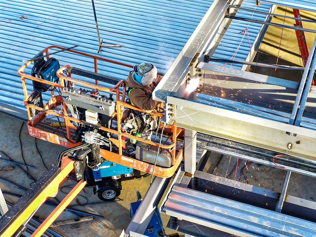
Doster’s Safety Department uses drone videography and photography to document work activities that are not easily or safely accessible by person. The drone gives them the vantage point to view the work and the team safely and with minimal distraction.
3. In the Field
Using drones as our projects are underway has yielded big benefits for our project teams. By being deployed in the field and having a drone pilot on-site, our project teams can document activities and better understand what’s happening on-site. Our certified drone pilots fly multiple times a month, keeping our client and everyone on the team (either in the office or in the field) updated in real-time.
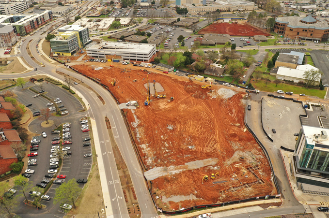
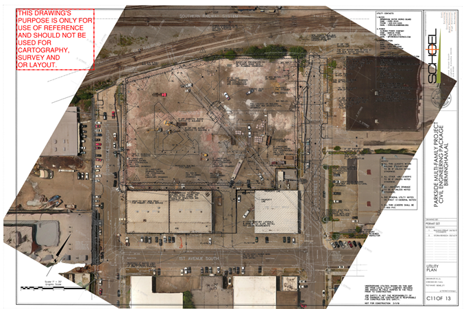
The aerial perspective also has added benefit to project validation. The ability for our field team to take an overhead shot of a slab to validate and document PT cable placement has proved to be superior over traditional photography. To help verify layout, we can overlay the project drawing with the drone photos to quickly tell if the building slabs are being formed in the correct location.
The Drone Program is a prime example of how Doster’s Core Values drive us to continual improvement, and it’s been paying huge dividends helping us communicate and mitigate project risk.
Click here to learn more about how Doster is using technology in construction.